This page discusses World War II aerial photos taken by the Royal Air Force (RAF) and provided on-line by the Geo-spatial Digital Archive Project (GDAP)1 in its Williams-Hunt Aerial Photograph Digital Collection.2 3
In the following, aerial photos were joined into mosaics using assembled with Microsoft’s ICE, a panorama program, as described.
Photomosaic No. 1
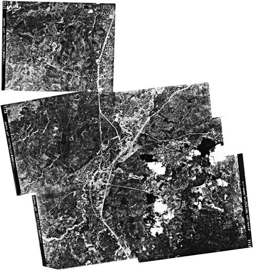
The area around Mae Chan outlined above in red was recorded in seven RAF aerial photos taken on 05 October 1944:4
A higher resolution image is available for downloading here.5
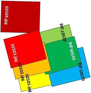
The following GDAP images were used in the above photomosaic and are available as a bundled download here:6
02501.jpg
02502.jpg
02503.jpg
02504.jpg
02505.jpg
02506.jpg
02507.jpg
and assembled approximately like this, using a combination of Microsoft ICE and manual fitting:7
Photomosaic No. 2
An alternate, macro, two-photo view, undated, as outlined in blue on the site map above, was also recorded:8
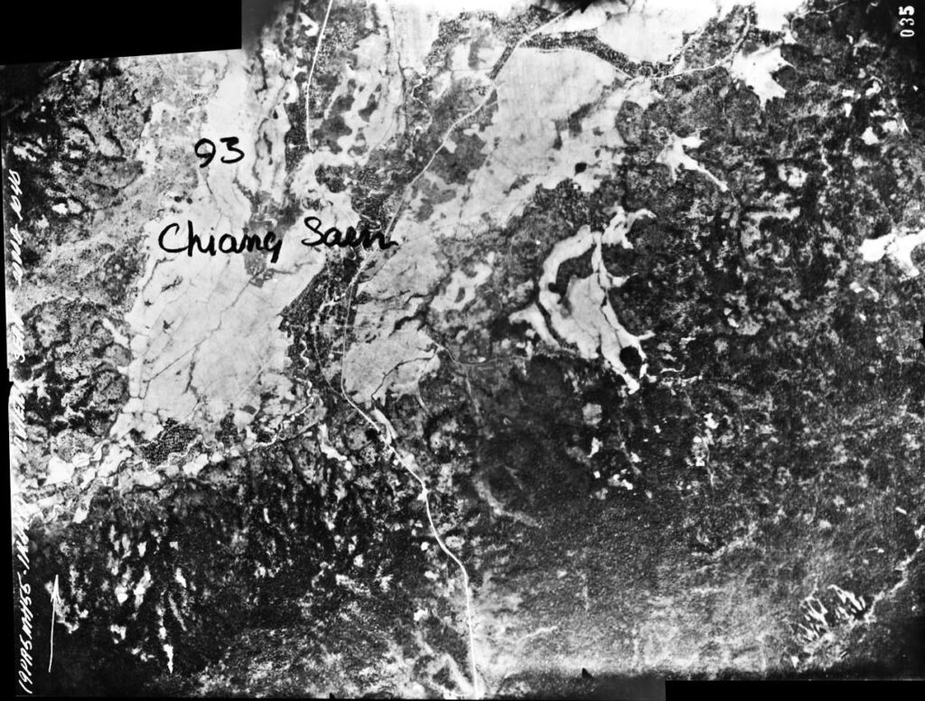
A higher resolution image is available for download here. The handwritten “Chiang Saen” is irrelevant here and is discussed at Chiang Saen.
The following GDAP images were used in the above photomosaic:
and assembled approximately like this, with ICE:11
GDAP, the source of these photos, has asked that the following information be included regarding the aerial imagery shown above:
- Williams-Hunt Aerial Photos Collection
- Original from the School of Oriental and African Studies (SOAS), University of London
- Digital Data from Center for Southeast Asia Studies (CSEAS), Kyoto University
- Digital Archive from Chulachomklao Royal Military Academy (CRMA), Thailand
| First published on Internet | ||
| Converted to WordPress by Ally Taylor | ||
| Updated, author errors & typos corrected | ||
Last Updated on 11 January 2026
- webpage, at link <http://gdap.crma.ac.th/> is no longer available[↩]
- webpage, at link <http://gdap.crma.ac.th/index.php?option=com_content&view=article&id=14&Itemid=3> is no longer available. The collection and its origin are described in detail in:
● Lertlum, PhD, Col Surat, and Dr Elizabeth Moore, Williams-Hunt Aerial Photograph Collection, (undated); available as here linked.
● Moore, Elizabeth, The Williams-Hunt Collection, Sari – International Journal of the Malay World and Civilisation, 27(2)(2009), pp 265-284.
● Periasamy, Makeswary, “A View from the Top”, biblioasia, 5(1) (Apr 2009), pp 38-42.The Williams-Hunt collection has two separate sets of aerial photos for Mae Chan:((N20°08.8 E99°51.2 Source: Google Earth fix on apparent center of town.[↩]
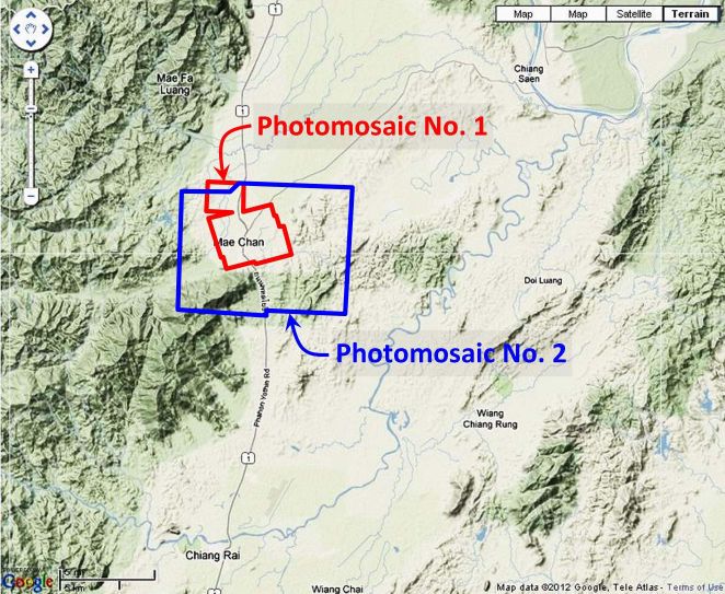
- “Terrain” map from Nations Online Project: Searchable Map and Satellite View of Thailand using Google Earth Data (link: http://www.nationsonline.org/oneworld/map/google_map_thailand.htm is no longer available). Annotation (red & blue colored items) placed with PhotoShop by author; my ref:\02370 Other locations\02370 Mae Chan\WH aerials\Mae Chan Lctn map1-2.jpg[↩]
- Photos were assembled using Microsoft’s ICE (Image Composition Editor) as much as possible. Order of assembly was important: images 02501-02503 and 02505-02507 were assembled first and then joined. 02504 had to be manually added to the resulting composite because it did not sufficiently overlap with the other photos for the ICE program to stitch them together. Mosaic has been oriented so that north is top-of-page. My ref: \bPROJECT\_MAPS\THAILAND Maps\Williams-Hunt (WH) Aerials\CNR\CNR realigned OK\CNR composite#2 2501-2507 Mae Chan ok\02501-3,5-7+4_stitchaa-tilt.jpg[↩]
- my ref: \bPROJECT\_MAPS\THAILAND Maps\Williams-Hunt (WH) Aerials\CNR\CNR realigned OK\CNR composite#2 2501-2507 Mae Chan ok\02501-3,5-7+4_stitchaa-tilt.zip[↩]
- The files used here are ~200 KB. My refs: \bPROJECT\_MAPS\THAILAND Maps\Williams-Hunt (WH) Aerials\CNR\CNR realigned OK\CNR composite#2 2501-2507 Mae Chan ok\a0250xx.jpgs[↩]
- Drawn with Microsoft Publisher by author; my ref: \bPROJECT\_MAPS\THAILAND Maps\Williams-Hunt (WH) Aerials\CNR\CNR Originals\Chang Saen (Mae Chan) 2\Mae Chan assy dwg.jpg.[↩]
- Photos were assembled using Microsoft ICE. Mosaic has been reoriented so that its approximate north is to the top of the page. My ref: \02370 Other locations\02370 Chiang Saen\WH aerials\a02508a_stitch.jpg[↩]
- my ref: \02370 Other locations\02370 Chiang Saen\WH aerials\a02508a.zip[↩]
- my ref: \02370 Other locations\02370 Chiang Saen\WH aerials\a02509a.zip[↩]
- Drawn with Microsoft Publisher by author; my ref: \02370 Other locations\02370 Chiang Saen\WH aerials\02508-9_stitch-assy3.jpg.[↩]