This page discusses World War II aerial photos taken by the Royal Air Force (RAF) and provided on-line by the Geo-spatial Digital Archive Project (GDAP)1 in its Williams-Hunt Aerial Photograph Digital Collection.2
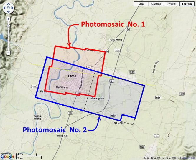
The Williams-Hunt collection has two separate sets of aerial photos for Phrae,3 both dated in 1944 and located as shown:4
In the following, all the aerial photos were joined manually into mosaics because Microsoft’s ICE, a panorama program, introduced too much distortion.
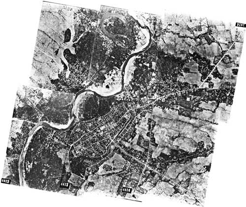
Photomosaic No. 1
The area around Phrae outlined above in red was recorded in six RAF aerial photos taken on 07 March 1944:5
A higher resolution image, zipped, is available for download here.
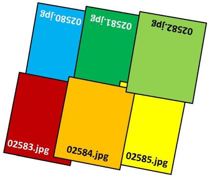
The following GDAP images were used in the above photomosaic6
02580.jpg
02581.jpg
02582.jpg
02583.jpg
02584.jpg
02585.jpg
and are available as a zipped bundle here.7 They were manually assembled approximately like this:8
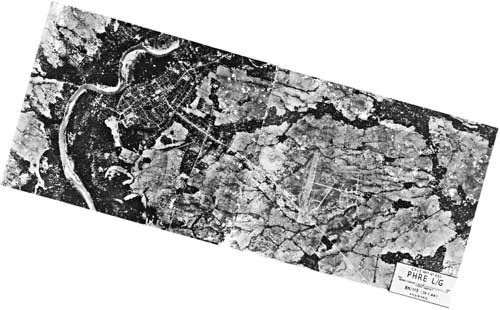
Photomosaic No. 2
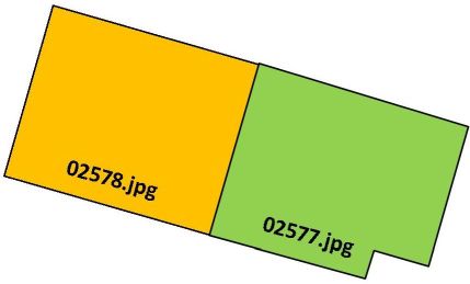
An alternate, macro, two-photo view dated 24 January 1944, as outlined in blue on the site map above, was also recorded:9
A higher resolution image is available for download here.
The following GDAP images were used in the above photomosaic:10
and manually assembled approximately like this:11
GDAP, the source of these photos, has asked that the following information be included regarding the aerial imagery shown above:
- Williams-Hunt Aerial Photos Collection
- Original from the School of Oriental and African Studies (SOAS), University of London
- Digital Data from Center for Southeast Asia Studies (CSEAS), Kyoto University
- Digital Archive from Chulachomklao Royal Military Academy (CRMA), Thailand
| First published on Internet | ||
| Converted to WordPress by Ally Taylor | ||
| Updated, author errors & typos corrected | ||
Last Updated on 13 January 2026
- webpage, at link <http://gdap.crma.ac.th/>, is no longer available[↩]
- webpage, at link <http://gdap.crma.ac.th/index.php?option=com_content&view=article&id=14&Itemid=3>, is no longer available. The collection and its origin are described in detail in:
● Lertlum, PhD, Col Surat, and Dr Elizabeth Moore, Williams-Hunt Aerial Photograph Collection, (undated); available as here linked.
● Moore, Elizabeth, The Williams-Hunt Collection, Sari – International Journal of the Malay World and Civilisation, 27(2)(2009), pp 265-284.
● Periasamy, Makeswary, “A View from the Top”, biblioasia, 5(1) (Apr 2009), pp 38-42.[↩] - N18°08 E100°09 Source: Google Earth fix on apparent center of town.[↩]
- “Terrain” map from Nations Online Project: Searchable Map and Satellite View of Thailand using Google Earth Data (link: http://www.nationsonline.org/oneworld/map/google_map_thailand.htm is no longer available). Annotation (red & blue colored items) placed with Microsoft Publisher by author; my ref: \02370 Phrae, KaengLuang\WH\Phrae photomosaic locatns.jpg[↩]
- Photos were manually assembled. The mosaic is oriented so that north is top-of-page.[↩]
- average size is 200 KB[↩]
- my ref: bPROJECT\_MAPS\THAILAND Maps\Williams-Hunt (WH) Aerials\Phrae\Phrae relignmts\Phrae composite 1 ok\Phrae composite 1 ok.zip[↩]
- Drawn by author using Microsoft Publisher; my ref: \02370 Other locations\02370 Phrae, KaengLuang\WH\Phrae photomosaic locatn-1.jpg[↩]
- Again, photos were manually assembled with mosaic reoriented so that north is top-of-page; my ref: \02370 Other locations\02370 Phrae, KaengLuang\WH\Phrae-meld-02577-8.jpg[↩]
- \02370 Other locations\02370 Phrae, KaengLuang\WH\0257x.jpgs[↩]
- Drawn with Microsoft Publisher by author; my ref: \02370 Other locations\02370 Phrae, KaengLuang\WH\Phrae photomosaic locatn-2.jpg.[↩]