12.
Uttaradit Aerial Photomosaic
This page discusses World War II aerial photos taken by the Royal Air Force (RAF) and provided on-line by the Geo-spatial Digital Archive Project (GDAP)1 in its Williams-Hunt Aerial Photograph Digital Collection.2 3
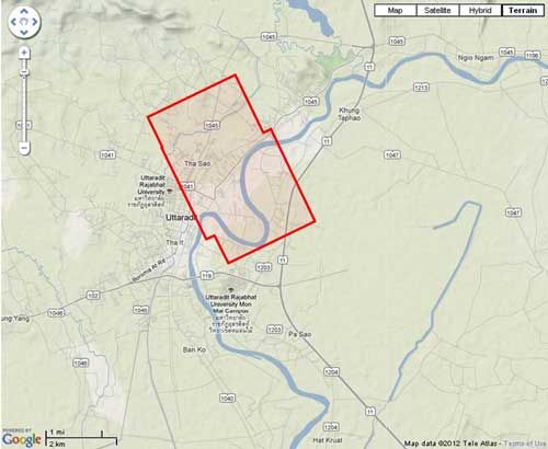
The Williams-Hunt collection has a single set of aerial photos for Uttaradit4 dated 06 April 1944 and located:5
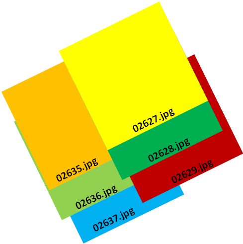
The following GDAP images were used in making the photomosaic:
| 02635.jpg | 02627.jpg |
| 02636.jpg | 02628.jpg |
| 02637.jpg | 02629.jpg |
and assembled approximately like this, using manual fitting:6
Stitching the six-photos together produced this aerial photomosaic:
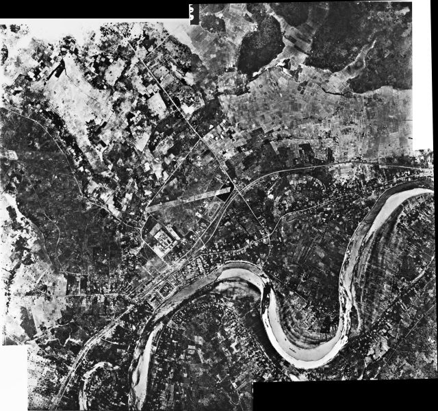
A higher resolution image is available for download here.
GDAP, the source of these photos, has asked that the following information be included regarding the aerial imagery shown above:
- Williams-Hunt Aerial Photos Collection
- Original from the School of Oriental and African Studies (SOAS), University of London
- Digital Data from Center for Southeast Asia Studies (CSEAS), Kyoto University
- Digital Archive from Chulachomklao Royal Military Academy (CRMA), Thailand
| First published on Internet | ||
| Converted to WordPress by Ally Taylort | ||
| Updated, author errors & typos corrected | ||
Last Updated on 7 January 2026
- link: http://gdap.crma.ac.th/, no longer active[↩]
- link: http://gdap.crma.ac.th/index.php?option=com_content&view=article&id=14&Itemid=3, no longer active[↩]
- The collection and its origin are described in detail in these zip files:
● Lertlum, PhD, Col Surat, and Dr Elizabeth Moore, Williams-Hunt Collection, (undated); available as here linked.
● Moore, Elizabeth, Williams-Hunt Collection, Sari – International Journal of the Malay World and Civilisation, 27(2)(2009), pp 265-284.
● Periasamy, Makeswary, Williams-Hunt Collection, biblioasia, 5(1) (Apr 2009), pp 38-42.[↩] - N17°37.60 E100°05.80 Source: Google Earth fix on apparent center of town.[↩]
- “Terrain” map from Nations Online Project: Searchable Map and Satellite View of Thailand using Google Earth Data (function no longer available). Annotation (red & blue colored items) were by author using Microsoft Publisher.[↩]
- Drawn by author with Microsoft Publisher.[↩]