Finding Demezas Crash Site
On 18 October 2008, Jack Eisner interviewed an eye witness to Demezas’s crash, Maytah Gietpong. Jack found Maytah’s recollections to have been seriously confused with an earlier air battle over Lampang on 11 November 1944 which included the death of another USAAF pilot, Henry Minco. Those extraneous details have been edited out in the following:1
- Interviewee: Maytah Gietpong
- Age: 81 [b ~1927]
- Lampang was site for two Japanese airfields (a third, he said, was very small) [To clarify, there was Lampang Airfield, plus three subordinate airfields around Lampang:
- Lampang2 (Google Maps link) (before the war, a US War Department report listed Lampang as a “military landing ground”; during the war, it appeared that both RTAF and IJAAF used the airfield).
- Ko Kha3 (Google Maps link) about 13 km to the SW (built adjacent to a sugarmill before the war, but not clear who controlled during the war)
- Mae Mo4 (Google Maps link) about 28 km to the NE (built by Japanese)
- Hang Chat5 (Google Maps link) about 14 km to the NW] (built by Japanese)
- Japanese planes were small, two-pilot aircraft [the 31st Sentai with Ki-30 light bombers (offsite link) was located in Lampang early in the war; Ki-30s had a two man crew.]
- Lived in Mubahn Huah Wieng, near the Wang River
- Student at Kenneth Mackenzie School6 (Google Maps link) [founded by American Presbyterian missionary in 1941], but school was closed. Transferred to Boonyawart High School7 (Google Maps link).
- Mackenzie School located on Charoen Muang Road [? Charoen Prathet Road), Pongsanuk, Bo Haeo, Amphur Muang, Lampang. The school was located between Pong Sanuk Road on the south, along the river, and Jamathaewee Road on the north (present Thai Highway 1039) ]
- Aerial bombing raids of Lampang had become common by 1944. The main targets were the train station,8 railroad bridge9 on the Wang River (Google Maps links), and airports.
- [12 July 1945] . . . bathing in river, about 1 km west of his house, just northeast of Mackenzie School [school on west bank]. Many people were at the river [both banks], bathing, washing, etc. . . .
- One Allied plane was hit, and crashed in the forest, about 3 km southwest of McKenzie School. . . .
- When people at the river, including Maytah, saw the pilot parachute, they left the river and ran in his direction. About 20-30 people ran about 15-20 minutes. [a sustained jugging speed might be 10 km/hr, or 3+ km in 20 minutes; since Maytah did not mention crossing the Wang River, his direction of travel would have been restricted to a westerly direction.]
- Thai and Japanese soldiers in their respective trucks, about 10 soldiers in each group, also headed for the pilot.
- The townspeople arrived at the parachute site first. Maytah saw the pilot, a blond-haired young man, who appeared to be about 18 yrs old, hiding among the trees.
- Maytah, who had learned some English at McKenzie School, approached the pilot, saying “Come here, come here.” The pilot appeared frightened, but came out from behind the trees.
- The Japanese and Thai soldiers were just a few minutes behind the townspeople. The townspeople wanted to protect the pilot from the Japanese. By this point in the war, there was distrust between Thais and Japanese.
- The townspeople surrounded the soldier, hiding him from the Japanese soldiers. When the Thai soldiers arrived in their truck, they handed him over to them. The Thai soldiers drove off to the Lampang Thai army base – Kai Surasak Montri.10 . . .
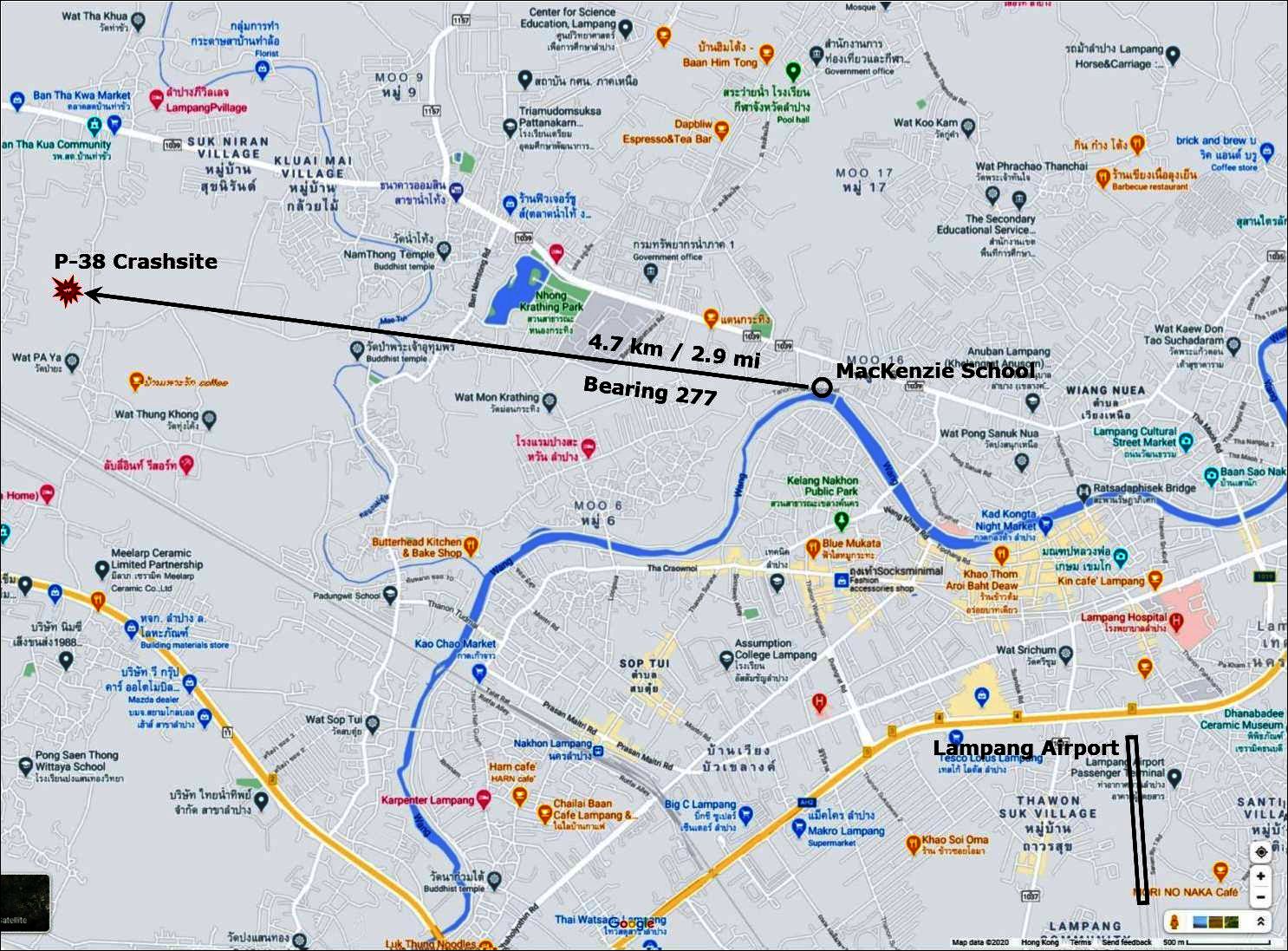
Maytah’s information on the ground about the location where Demezas landed was considered to be more accurate than Stanton’s description looking down from an altitude of 3000 feet as recorded in the MACR. Thus we followed Maytah’s description, traveling westward querying people to eventually locate a village, Ban Pa Ya11 (Google Maps link), where people were familiar with an aircraft having crashed nearby during the war.
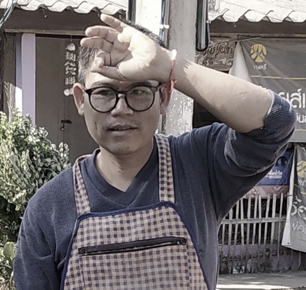 Rattasat Bpanlaoya (age 48)12
15 Moo 11 Ban Pa Ya13 (Google Maps link)
Tambon Bo Haeo
รัฐศาสตร์ ปันเลายา
15 หมู่ 11 บ้านป่ายะ
ตำบลบ่อแฮ้ว อำเภอเมือง ลำปาง
He recounted that his grandmother, when aged 73, had spoken to him of a plane crashing in the rice paddy behind Wat Pa Ya. He claimed that the rice paddies were now inaccessible. He recommended checking with another village resident, across Tha Kua Road, a 95 year old lady, for further information:
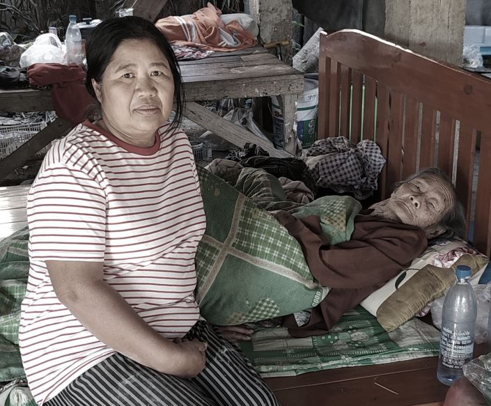
Ms Bpuan Kanjai14
49 Moo 11 Ban Pa Ya15 (Google Maps link)
Mother : นางปวน คันใจ
Daughter : นางคำสุข คันใจ
49 หมู่ 11 บ้านป่ายะ
ตำบลบ่อแฮ้ว อำเภอเมือง ลำปาง
Aged 20 at the time of the crash, and now bedridden, with faulty memory, Ms Bpuan in earlier years had told her daughter, Kamsook Kanjai, now aged 60, that a plane had crashed in the rice paddies behind Wat Pa Ya.
The search led west along a back road along the north side of the wat compound and then northerly skirting the paddies. A pedestrian on the road, a Ms Laa, aged 79 and also a Pa Ya resident, pointed off to the north when asked about an aircraft crash.
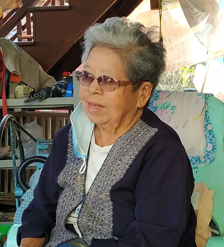
Continuing north on the Tha Kua Road eventually led to an intersection with an unnamed soi on which Ms Lai Jaila-au (unrelated to Ms Laa) lived:
Ms Lai Jaila-au16
112 Ban Nong Chang Dtai17 (Google Maps link)
Tambon Bo Haeo, Lampang
นางไหล่ ใจละออ
112 บ้านหนองช้างใต้
ตำบลบ่อแฮ้ว อำเภอเมือง
จังหวัดลำปาง
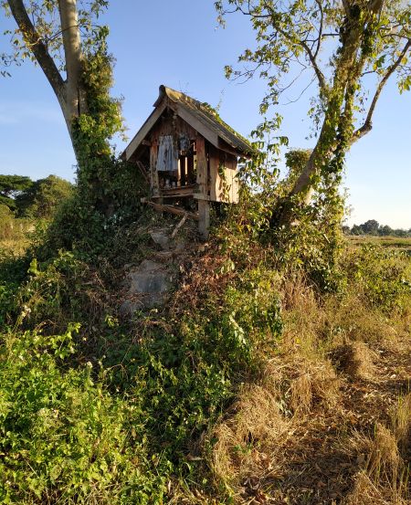
Seven years old at the time of the crash, Ms Lai explained that the plane had crashed near a community spirit house18 (Google Maps link) located out in the paddies. The spirit house had been erected years before the crash in the traditional belief that its presence would protect the village; she explained that, indeed, it had been the spirit house which had ensured that the crash occurred outside the village, and had not hurt anyone:19
 Ms Lai described what she could recall. The village, Ban Nong Chang Dtai, consisted of seven or eight houses, one of which had belonged to her parents, and was where she now lived. There had been no electric power nor telephone service; the north-south Tha Kua Road, providing access to the village was not paved, and the village soi, not formally dedicated, was just a dirt track.
She said that there had been a very loud explosion which frightened the villagers, sending them to hide in a village bunker. At the time, no one looked skyward, so no one saw anything of a parachute (there was no talk of a parachute afterwards). Looking out from the bunker, they could see a great fire in a paddy near the village.
Japanese soldiers arrived at the site very quickly, while the wreckage was still burning. They were apparently guided to the site by the column of smoke from the burning wreckage. The soldiers warned the villagers to stay away. Villagers were eventually allowed to salvage metal from the site (note that the war ended only a month later). Ms Lai’s son, Satian, born 19 years after the end of the war (in 1964), remembers seeing a small pile of wreckage still in the village in his early years.
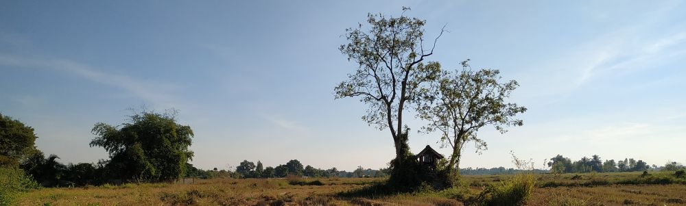
The view from the end of the soi looking towards the spirit house::20
Conclusions
Military records of crash site
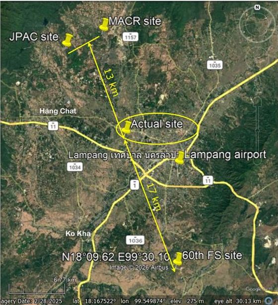
In the search for Demezas’s crash site, our relying on statements from Jack Eisner’s interview with Maytah proved to be the best guide to finding the site — had we followed the US military reports available, we would have been looking at potential sites at substantial distants as shown from the finally determined site, and of course found nothing:
- 13 km NW of actual site:
- USAAF Missing Aircrew Report (MACR 14710): N18°25 E99°25 (Google Maps link)
- Joint POW/MIA Accounting Command (JPAC): N18°23.94 E99°22.46 (Google Maps link. Calculated from “12 miles northwest of the Lampang airfield, 1st Lt Demezas successfully bailed out”)
- 17 km SE of actual site:
- USAAF 60th Fighter Squadron Weekly Report (60th FS): N18°09.62 E99°30.10 (Google Maps link. Calculated from “Pilot was observed to bail out and land safely 8 miles south of Lampang”)
And summarized here:21
Actual crash site location
- Location of community spirit house22 per Ms Lai
- Approximate location of crash site23 per Ms Laa
Distance between the two on-the-ground estimates for the crash site location: about 0.37 km on a basically N-S line. Arbitrarily averaging the locations of the two points, the crash location was at about N18°18.262 E99°26.541. That is about 4.65 km in a westerly direction (bearing 277) from MacKenzie School, and 7.5 km NW of the airfield (bearing 300).
Summary map:24
Where Demezas actually landed by parachute is as vague as was the location of the crash site. 1Lt Stanton recorded Demezas landing about 35 yards from the actual crash site, but none of the people around the crash site recalled seeing a parachute, nor the gathering of Thais and Japanese around Demezas at a Jujube wood, We did not pursue it.
Afterword:
Following Demezas’ release from a POW camp in Bangkok, he returned to the US where he accepted a reserve commission as a captain. He was recalled to active duty in the Korean War from September 1950, and continued on active duty until retirement in 1967 as a Lt Col. He then worked for Oregon’s Department of Employment to retirement in 1984. He died, aged 79, on 07 May 2003. He was survived by wife, five children, and numerous grandchildren.25
(Continued: Cherdchai’s Missing Allied Pilot)
- provided by Jack Eisner email of 11:43 05 Jan 2021[↩]
- Lampang airport: N18°16.33 E99°30.24[↩]
- Ko Kha airport: N18°12.04 E99°24.70[↩]
- Mae Mo airport: N18°24.71 E99°43.71[↩]
- Hang Chat airport: N18°21.5 E99°24.4[↩]
- N18°18.03 E99°29.15[↩]
- N18°17.23 E99°30.14[↩]
- N18°17.00 E99°28.00[↩]
- N18°17.05 E99°27.86[↩]
- N18°17.60 E99°30.95[↩]
- N18°18.00 E99°26.60[↩]
- My ref: \02500 Tango\_Crash sites N TH for Tango\DETAIL SHEETS\A450712 Demezas [A12] (1)\Site visit 20201223\Photos\aIMG_20201223_145107.jpg[↩]
- N18°18.076 E99°26.562[↩]
- My ref: \02500 Tango\_Crash sites N TH for Tango\DETAIL SHEETS\A450712 Demezas [A12] (1)\Site visit 20201223\Photos\aIMG_20201223_151203.jpg[↩]
- N18°18.022 E99°26.621[↩]
- My ref: \02500 Tango\_Crash sites N TH for Tango\DETAIL SHEETS\A450712 Demezas [A12] (1)\Site visit 20201223\Photos\[↩]
- N18°18.42 E99°26.59[↩]
- ~N18°18.364 E99°26.542[↩]
- Photo of spirit house by author; my ref: \02500 Tango\_Crash sites N TH for Tango\DETAIL SHEETS\A450712 Demezas [A12] (1)\Site visit 20201223\Photos\aIMG_20201223_163359.jpg[↩]
- Photo by author: my ref: \02500 Tango\_Crash sites N TH for Tango\DETAIL SHEETS\A450712 Demezas [A12] (1)\Site visit 20201223\Photos\aIMG_20201223_155803.jpg[↩]
- Google Earth excerpt annotated by author using Microsoft Publisher; my ref: \02500 Tango\_Crash sites N TH for Tango\DETAIL SHEETS\A450712 Demezas [A12] (1)\Misc\Recorded crash sites-anno.jpg[↩]
- N18°18.364 E99°26.542[↩]
- N18°18.16 E99°26.54[↩]
- Google Maps excerpt annotated by author using Microsoft Publisher; my ref: \02500 Tango\_Crash sites N TH for Tango\DETAIL SHEETS\A450712 Demezas [A12] (1)\Site visit 20201223\Rpt Map\LPG map composite.jpg[↩]
- obit: Statesman Journal, 09 May 2003, p A12, “Lt Col Theodore H Demezas”; my ref: \02500 Tango\_Crash sites N TH for Tango\DETAIL SHEETS\A450712 Demezas [A12]\Newspapers\20030509 obit Statesman Jl.jpg[↩]